Igor Witczak
Student - Geoinformatician - Programmer


About me
I am a 3rd year student of Geoinformatics at the Warsaw University of Technology. I specialize in GIS analyzes and programming web and desktop applications. Privately, I experiment with mobile applications.
I invite you to check out my portfolio.
Tools and programming languages
GIS software
ArcGIS Pro
QGiS
CloudCompare
Other software
FME
Jira
MS Office

Programming languages
Advanced level:
Python (with libraries: Numpy, Pandas, GeoPandas, Matplotlib, Kivy, Flask)
HTML, CSS, JavaScript (with Leaflet library)
At a basic level:
Kotlin (with the Compose framework)
Dart (with the Flutter framework)
C#/.NET (Engineering thesis)
Java
Database
SQL (PostgreSQL with PostGIS extension)
MongoDB
GIS projects
Projects completed during my academic studies
Multi-criteria analysis
Selecting the optimal investment strategy
ArcGIS Pro
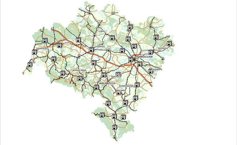
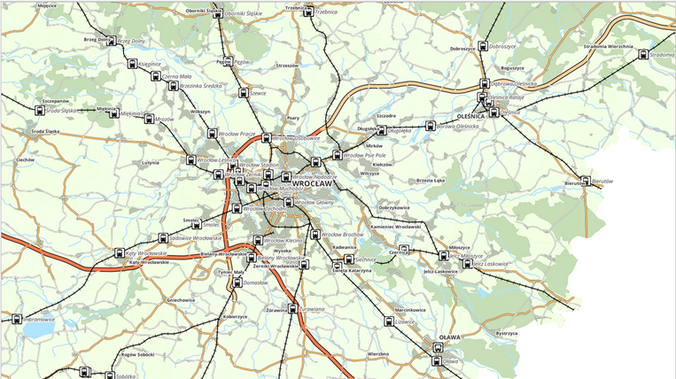
Interactive map
Railway and bus stations according to information from the BDOT10k Database.
QGiS
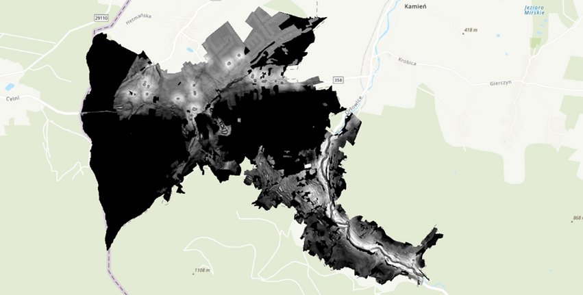
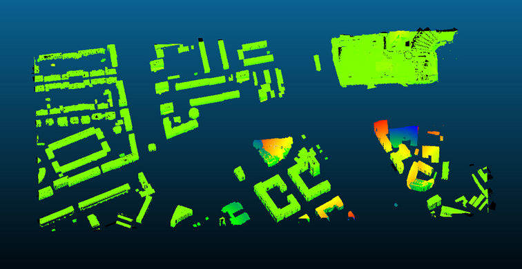
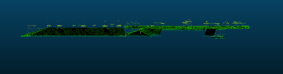
Evaluating the precision of 3D architectural models.
Derived from a laser scanning point cloud.
ArcGIS Pro and CloudCompare
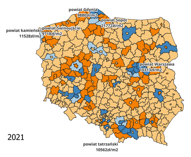
Analysis of the real estate market.
Research on the number of new apartments concerning resident inflow/outflow at the county level using data from the Central Statistical Office.
QGiS
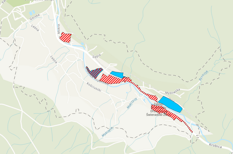
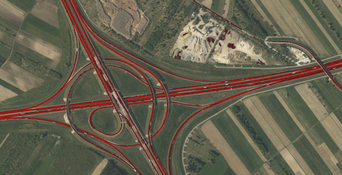
Development of a road detection algorithm utilizing aerial multispectral imagery.
QGiS
Software development initiatives
Projects completed during my academic studies
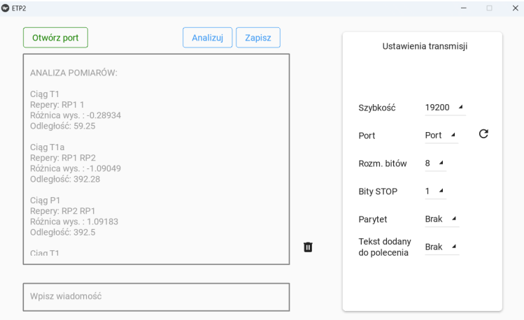
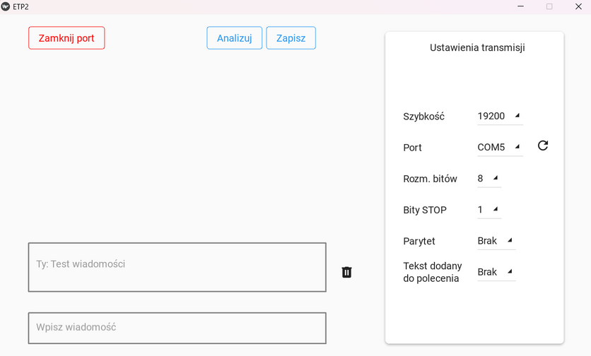
Application for data transmission
Utilizing an RS232 serial port or Bluetooth for communication between two devices with a module enabling the analysis of received geodetic measurements and transmission of commands to the measuring device.
Python
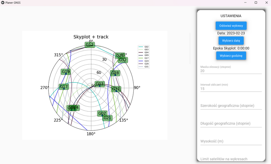
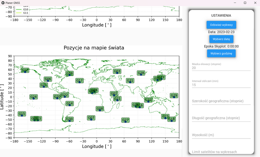
GNSS Planner
An app enabling visualization of GNSS satellite positions and parameters for planning GNSS measurements using satellite data from the Trimble server.
Python
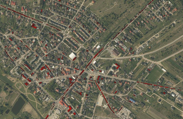
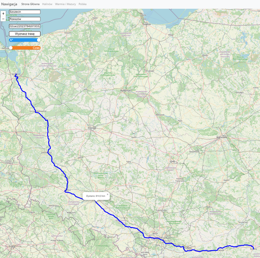
Internet navigation tool
By implementing navigation algorithms and a graphical interface, users can determine the shortest or fastest route between two addresses.
Based on road data from Geoportal.
(co-creator)
Python (Flask library), JavaScript (Leaflet)
Creation of a framework for storing spatial information in a NoSQL database (MongoDB)
Accompanied by a basic console application for adding, processing, and downloading data; utilizing Python tools and queries to the Mongo database.
Python libraries (NumPy, Pandas, PyMongo)
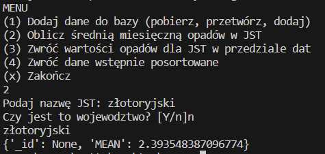
Terminal application
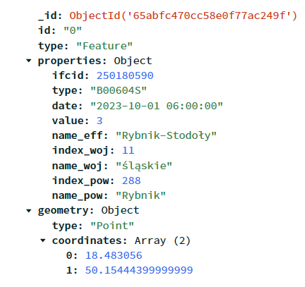
The database record structure.
SQL Database Project
Developing a database from the UML documentation of the BDOT10k database in SQL, incorporating indexes, views, and functions.
PostgreSQL (with PostGIS)
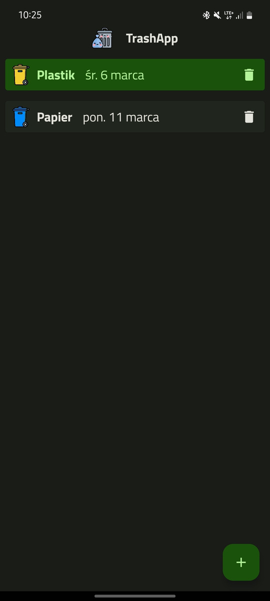
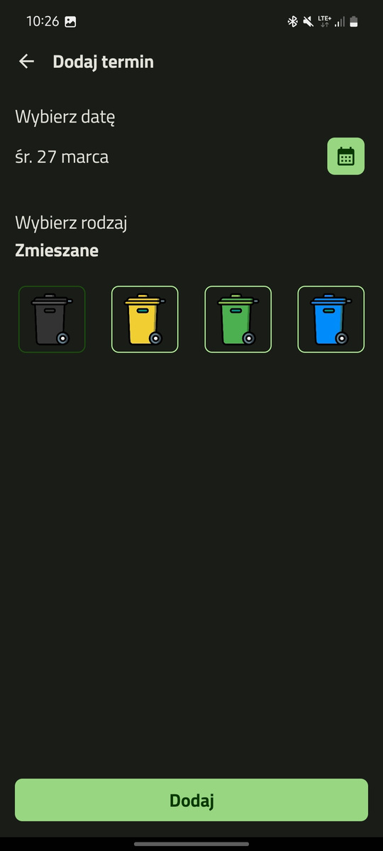
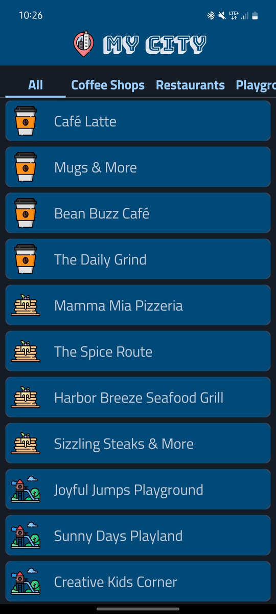
Mobile applications
Kotlin (Jetpack Compose)
Managing waste collection dates
Showing interesting points in the city
Mobile applications
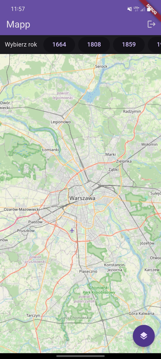
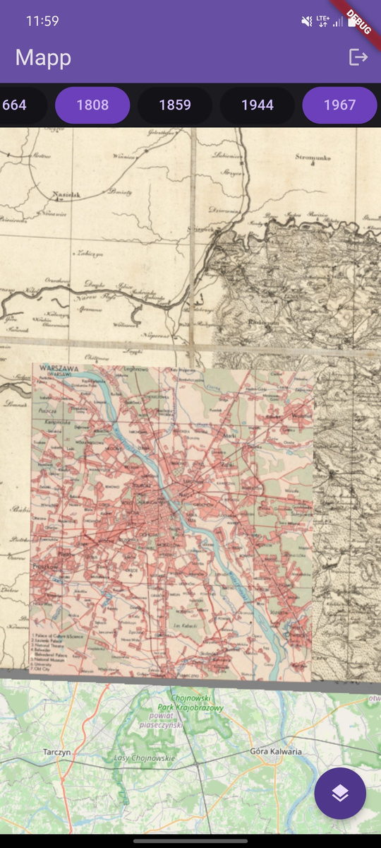
Dart (Flutter)
An application that displays archival georeferenced maps on top of a modern OSM map
Engineering thesis
Development of an indoor navigation system prototype based on RFID technology.
The project revolves around developing a straightforward yet fully operational IT system that enables the setup of RFID readers and the tracking of items fitted with RFID tags within the premises.
The system comprises multiple components:
- A desktop application for configuring the RFID reader and setting parameters for accessing the local network (using C#).
- Database which stores data collected from individual devices (PostgreSQL)
- REST server which connects readers to the database, enabling real-time transfer of readings and delivering data in a structured format (C#/.NET language).
- Mobile application that showcases the tagged objects location on the building map (Kotlin)